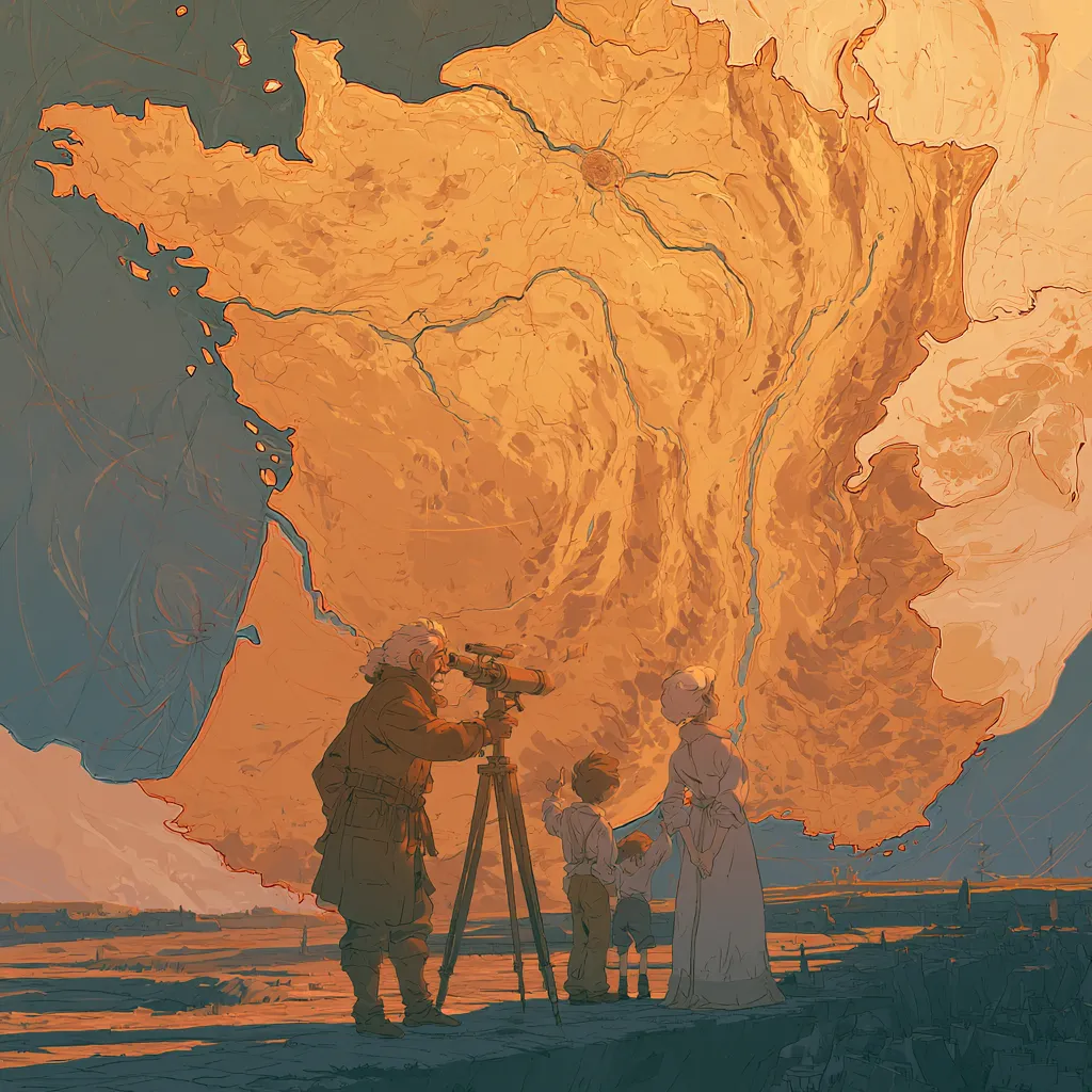
Long before satellites and smartphones, the art of mapping was a closely guarded secret, managed by a handful of dynastic families. In seventeenth-century Europe, maps were more than just navigational tools; they were instruments of power and prestige. Kings and generals relied on them to plan wars, collect taxes, and claim territory. At the heart of this world stood the Cassini family, Italian-born astronomers who would transform the very way Europe saw itself. Before the Cassinis, maps were pieced together from travelers’ tales, crude compasses, and guesswork. Borders shifted with every new political deal or rumor from distant villages. But the Cassini family, led by patriarch Giovanni Domenico Cassini, would soon bring the sky itself into the equation. Their mastery of astronomy and mathematics set them apart from the old mapmakers, who relied heavily on tradition and lore. Instead, the Cassinis looked up, using the stars as their guides. Their journey was not just about drawing lines on paper—it was about changing the way people understood the world around them. The stage was set for a revolution, and the Cassinis were ready to lead it.
 Chunks Microlearning
The Secret Birth of Modern Maps: The Cassini Family's Sky-High Surveys
How a family's telescopes and triangles redrew Europe long before GPS or satellites.
The First Mapping Dynasties
Frequently Asked Questions
How did the Cassini family revolutionize mapmaking in Europe before modern technology?
The Cassini family used telescopes and geometric triangulation to create the first accurate large-scale maps of France and other European regions. They established a network of precisely measured triangular surveys across the landscape, using astronomical observations to determine exact positions. This scientific approach replaced earlier maps that relied on rough estimates and local knowledge, creating the foundation for modern cartography centuries before GPS technology.
What was Jean-Dominique Cassini's innovative contribution to surveying and mapping?
Jean-Dominique Cassini developed systematic triangulation methods that used telescopes to sight distant landmarks and mathematical calculations to determine precise distances and positions. He established the Paris Observatory as the central point for France's national survey and trained teams of surveyors to extend triangular networks across the country. His work created the first scientifically accurate map of France, revealing that the country was actually smaller than previously thought.
Why was triangulation such an important breakthrough in 18th-century cartography?
Triangulation allowed surveyors to measure vast distances accurately using only angles and one known baseline distance, eliminating the need to physically traverse difficult terrain. By creating chains of connected triangles across the landscape, mapmakers could determine the exact positions of cities, coastlines, and borders with unprecedented precision. This method was so effective that it remained the standard for national surveys until satellite technology emerged in the 20th century.
Learn more
To continue the story, download the Chunks Microlearning app
Scan to download
Scan to download